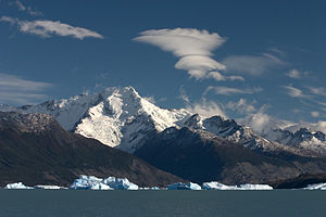
Argentina is subject to a variety of climates. The north of the country, including latitudes in and below the Tropic of Capricorn, is characterized by very hot, humid summers (which result in a lot of swamp lands) with mild drier winters, and is subject to periodic droughts during the winter season. Central Argentina has hot summers with tornadoes and thunderstorms (in western Argentina producing some of the world's largest hail), and cool winters. The southern regions have warm summers and cold winters with heavy snowfall, especially in mountainous zones. Higher elevations at all latitudes experience cooler conditions.The hottest and coldest temperature extremes recorded in South America have occurred in Argentina. A record high temperature of 52.8 °C (127.0 °F), was recorded at Campo Gallo, Santiago del Estero Province on October 16, 1936. The lowest temperature recorded was −40 °C (−40 °F) at Valle de los Patos Superior, San Juan, on July 8, 1966.The Sudestada (literally “southeastern”) could be considered similar to the Noreaster, though snowfall is rarely involved (but is not unprecedented). Both are associated with a deep winter low pressure system. The sudestada usually moderates cold temperatures but brings very heavy rains, rough seas, and coastal flooding. It is most common in late autumn and winter along the coasts of central Argentina and in the Río de la Plata estuary.The southern regions, particularly the far south, experience extremely long periods of daylight from November to February (up to fifteen hours), and extended nights from May to June. All of Argentina uses UTC-3 time zone. The country only observes daylight saving time occasionally, summer time was last observed between 0:00 December 30, 2007 and 0:00 March 16, 2008.ExtremitiesArgentina's easternmost continental point is northeast of the town of Bernardo de Irigoyen, Misiones (26°15′S 53°38′W), the westernmost in the Mariano Moreno Range in Santa Cruz (49°33′S 73°35′W). The northernmost point is located at the confluence of the Grande de San Juan and Mojinete rivers, Jujuy (21°46′S 66°13′W), and the southernmost is Cape San Pío in Tierra del Fuego (55°03′S 66°31′W).


Kommentieren
0