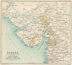
The Kathiawar Agency, on the Kathiawar peninsula in the western part of the Indian subcontinent, was a political unit of some 200 small princely states under the suzerainty of the Bombay Presidency of British India. Soon after India's independence in 1947, all but one of them acceded to the new Dominion of India and were merged into Bombay State. The region became part of the new Gujarat State in 1960, when Bombay State was split into Gujarat and Maharashtra states. There were altogether 193 states of varying size and importance, of which fourteen exercised independent jurisdiction, while the rest were to varying degrees under British administration. The eight states of the first class were Bhavnagar State, Dhrangadhra State, Gondal State, Jafarabad State, Junagadh State, Morvi State, Nawanagar State, and Porbandar State. The agency covered an area of 20,882 square miles (54,080 km2), and in 1901 the population was 2,329,196. The headquarters of the political agent (who oversaw the affairs of the princely states on behalf of the Governor-General) was at Rajkot, in the centre of the peninsula; this was also the site of the Rajkumar College, Rajkot, where many of the sons of the rulers were educated. There was a similar school for girasias, or chiefs of lower rank, at Gondal.The estimated gross revenue of the several states was 1,278,000 rupees in 1911; total tribute (payable to the British, the Gaekwar of Baroda and the nawab of Junagadh), was 70,000 rupees. An excellent system of metre-gauge railways was built at the cost of the leading states. Maritime trade was also very active, the chief ports being Porbandar, Mangrol and Veraval. In 1903–1904 the total sea-borne exports were valued at 1,300,000 rupees, and the imports at 1,120,000. The progressive prosperity of Kathiawar received a shock from the famine of 1899-1900, which was felt everywhere with extreme severity; between 1891 and 1901 the population of the states covered by the Agency decreased by 15 per cent, largely due to the results of the famine.


Comentar
0