
Cargando...
¿Qué puedo hacer?
Encuentra
visualización
Pueblo
Measham is a large village in Leicestershire, situated close to the borders with Derbyshire, Staffordshire and Warwickshire; located just off the A42 and 4.5 miles (7.25 km) south of Ashby-de-la-Zouch ...
Asentamiento
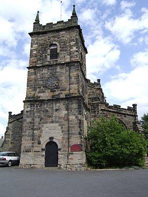
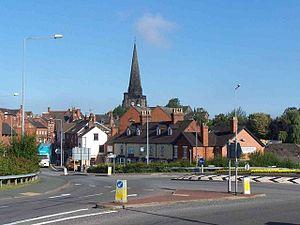
Dresden is a southern district of Stoke-on-Trent, Staffordshire, England, situated on the Trentham Road (A5035), to the south of, and part of, the town of Longton.The district was developed in the 19t ...
Asentamiento
Silverdale es una parroquia civil y un pueblo del distrito de Newcastle-under-Lyme, en el condado de Staffordshire (Inglaterra).
Persona
Alfred William Goldie (December 10, 1920, Coseley, Staffordshire – October 8, 2005, Barrow-in-Furness, Cumbria) was an English Mathematician.Goldie was educated at Wolverhampton Grammar School and the ...

Persona
Hugh Dancy (Staffordshire, 19 de junio de 1975) es un actor y modelo británico. Actor de cine, teatro y televisión conocido por ser el protagonista de la serie de NBC Hannibal (2013-) y por papeles en ...
Río
El río Tern (históricamente conocido como el Tearne) es un río que está en el condado inglés de Shropshire. El río nace en el noreste de la ciudad de Market Drayton, al norte del condado. Se considera ...
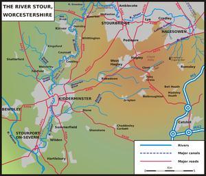
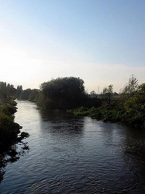
The Stour /ˈstaʊər/ is a river flowing through the counties of Worcestershire, the West Midlands and Staffordshire in the West Midlands region of England. The Stour is a major tributary of the River S ...
Asentamiento
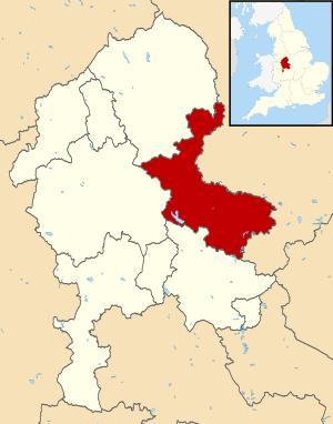
East Staffordshire es un distrito no metropolitano con el estatus de municipio, ubicado en el condado de Staffordshire (Inglaterra). Tiene una superficie de 386,96 km². Según el censo de 2001, East St ...
Asentamiento
Uttoxeter (/juːˈtɒksɨtər/ or sometimes locally uh-CHET-ər ) is a market town in Staffordshire, England. In 2001, the population was 12,023.Uttoxeter lies close to the River Dove in East Staffordshire, ...
Área Protegida
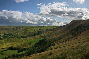
El Distrito de los Picos es una área de tierras altas en Inglaterra central y del Norte, que se encuentra principalmente en el Norte de Derbyshire, pero que también cubre partes de Cheshire, Gran Manc ...
Añadir a Didactalia Arrastra el botón a la barra de marcadores del navegador y comparte tus contenidos preferidos. Más info...


