226305 materialEducativo

textoFiltroFicha
  • Eu curto 0
  • Visitas 16
  • Comentarios 0
  • Guardar en
  • Ações

Sobre este recurso...

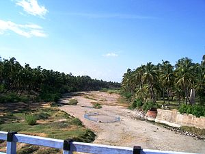
Noyyal River
River
Artículo WikipediaFuente Dbpedia
The Noyyal River rises from the Vellingiri hills in the Western Ghats in Tamil Nadu, southeastern India and drains into the Kaveri River. The river's basin is 180 km (110 mi) long and 25 km (16 mi) wide and covers a total area of 3,500 km2 (1,400 sq mi). Cultivated land in the basin amounts to 1,800 km2 (690 sq mi) while the population density is 120 people per km² (311/mi²) in the countryside, and 1000 people per km² (2590/mi²) in the cities. The area is known for its scanty rainfall and the development of the Noyyal River Tanks System to hold any overflow from the rains plus the water of the Northeast and Southwest monsoon season was ecologically important. The 173 km (107 mi) long tributary of the Kaveri River filled 32 tanks. These interconnecting tanks held the water flowing from the Noyyal.
Noyyal River
Longitud 180000.000000
Cuenca hidrográfica (km2) 3500000000.000000 3625983354.470400

Mapa conceitual: Noyyal River

Conteúdo exclusivo para membros de

D/i/d/a/c/t/a/l/i/a
Iniciar sessão

Mira un ejemplo de lo que te pierdes

Categorias:

Fecha publicación: 1.10.2014

Comentar

0

Deseja fazer um comentário? Registrar o Iniciar sessão

Junte-se à Didactalia

Navegue entre 226305 recursos e 560604 pessoas

Regístrate >

O conéctate a través de:

Si ya eres usuario, Inicia sesión

Você quer acessar mais conteúdo educacional?

Iniciar sessao Participar de uma aula
x

Adicionar ao Didactalia Arrastra el botón a la barra de marcadores del navegador y comparte tus contenidos preferidos. Más info...

Ajuda do jogo
Juegos de anatomía
Selecciona nivel educativo