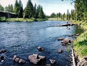
Henrys Fork is a tributary river of the Snake River, approximately 127 miles (204 km) long, in southeastern Idaho in the United States. It is also referred to as the North Fork of the Snake River. Its drainage basin is 3,212 square miles (8,320 km2), including its main tributary, the Teton River. Its mean annual discharge, as measured at river mile 9.2 (Henrys Fork near Rexburg) by the United States Geological Survey (USGS), is 2,096 cubic feet per second (59.4 m3/s), with a maximum daily recorded flow of 79,000 cubic feet per second (2,240 m3/s), and a minimum of 183 cubic feet per second (5.18 m3/s).The river is named for Andrew Henry, who first entered the Snake River plateau in 1810. Employed by the Missouri Fur Company, he built Fort Henry on the upper Snake River, near modern St. Anthony, but abandoned this first American fur post west of the continental divide the following spring.
Longitud
204386.688000
Descarga máxima
2237.030881
Descarga mínima
5.181983
Desembocadura entre elevaciones
1463.040000
Elevación de origen
1949.805600
Cuenca hidrográfica (km2)
8319041810.399232


Comentar
0