
Cargando...
Que puis-je faire ?
Trouvez
visualisation
Hipervinculo Geografía
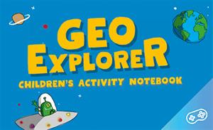
GeoExplorer has come to discover the Earth through games to learn astronomy, the interior of the Earth, geography and maps. Draw, colour, cut and learn more with links to other resources. Aimed at stu ...

This video shows how to orient yourself in the field in a traditional way through the use of a map and a compass, and through the use of map applications for mobile devices. Year of creation: 2019.

In this video GNSS technology foundations and use are explained, and also how it is used in mobile and in other more accurate applications, such as cartography or Earth dynamics knowledge. Year of cr ...

Although talking about earthquakes and tsunamis sounds exotic, they are very common and happen frequently near us. This video shows why they occur, the trigger and where the possibility of an event is ...

Discover the true shape of the Earth and how cartographic projections allow portray it in a flat surface in different ways depending on the purpose of the map. Year of creation: 2019.

A tour around the current technologies using satellites and airborne platforms for geographic information in order to study the territory and its changes. Year of creation: 2019.
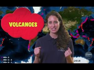
An overview of the types of eruptions, emitted materials and volcanic areas of Spain and the world through stunning videos and images. Year of creation: 2019.

Hipervinculo Geografía
Long ago, many people believed the world was flat. Explorers who loved geography—studying the earth—eventually proved it was round. As people learned more and more about what the world looked like, th ...
Didactic sequence for the didactic application of the TIC in Primary Education.
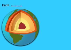
Do you know the name of each layer of the earth structure shown on the map? Test yourself with this interactive map.Es un mapa de la colección EastDock Media.
Ajouter à Didactalia Arrastra el botón a la barra de marcadores del navegador y comparte tus contenidos preferidos. Más info...


