
Cargando...
Zer egin dezaket?
226304 materialEducativo
textoFiltroFichatipo de documento Teknologia - Esperimentua/Praktika
Baliabide honi buruz...
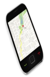
The increase in bicycle traffic has implications not only on the environment but our health as well. The GPS system has offered engineers the ability to gather terrain information more efficiently than traditional techniques. Not only can terrain information be gathered but also route calculations, which allow civic planners the ability to track trends in traffic. Design a safe bycicle route using a GPS
It is an educational content by education.com.
By clicking on the title of this resource, you will be redirected to the content. If you want to download the project, you just have to join the website, which now is for FREE.

Mira un ejemplo de lo que te pierdes
Autores:
Kategoriak:
Etiketak:
Fecha publicación: 12.5.2016
Baliabidearen jatorrizko lizentzia errespetatzen da.
Aipatu nahi al duzu? Erregistratu o Hasi saioa
Didactalia-ri Gehitzea Arrastra el botón a la barra de marcadores del navegador y comparte tus contenidos preferidos. Más info...


Aipatu
0