What can I do?

226305 materialEducativo

textoFiltroFicha
  • I like 0
  • Visits 5
  • Comments 0
  • Save to
  • Actions

About this resource...

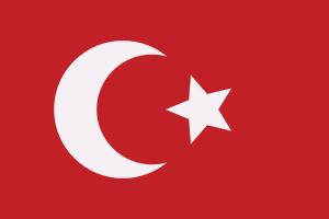
Salonica Vilayet
AdministrativeRegion
Wikipedia articleDbpedia source
The Vilayet of Salonica (Ottoman Turkish: ولايت سلانيك, Vilâyet-i Selânik) was a first-level administrative division (vilayet) of the Ottoman Empire from 1867 to 1912. In the late 19th century it reportedly had an area of 12,950 square miles (33,500 km2).The vilayet was bounded by the Principality (later Kingdom), of Bulgaria on the north; Eastern Rumelia on the northeast (after the Treaty of Berlin); Edirne Vilayet on the east; the Aegean Sea on the south; Monastir Vilayet and the independent sanjak of Serfije on the west (after 1881); the Kosovo Vilayet on the northwest.The vilayet consisted of present Central and Eastern parts of Greek Macedonia and Pirin Macedonia in Bulgaria. Present Pirin Macedonia part of it was administrated as kazas of Cuma-yı Bala, Petriç, Nevrekop, Menlik, Ropçoz and Razlık.[citation needed] It was dissolved after Balkan Wars and divided among Kingdom of Greece, Kingdom of Serbia and Tsardom of Bulgaria in 1913.
Salonica Vilayet

Conceptual map: Salonica Vilayet

Exclusive content for members of

D/i/d/a/c/t/a/l/i/a
Sign in

Mira un ejemplo de lo que te pierdes

Categories:

Fecha publicación: 27.5.2015

Comment

0

Do you want to comment? Sign up or Sign in

Join Didactalia

Browse among 226305 resources and 560592 people

Regístrate >

O conéctate a través de:

Si ya eres usuario, Inicia sesión

Do you want to access more educational content?

Sign in Join a class
x

Add to Didactalia Arrastra el botón a la barra de marcadores del navegador y comparte tus contenidos preferidos. Más info...

Game help
Juegos de anatomía
Selecciona nivel educativo