
Cargando...
What can I do?
226396 materialEducativo
textoFiltroFichatipo de documento Geography
About this resource...
Mapa para imprimir de Kamchatka
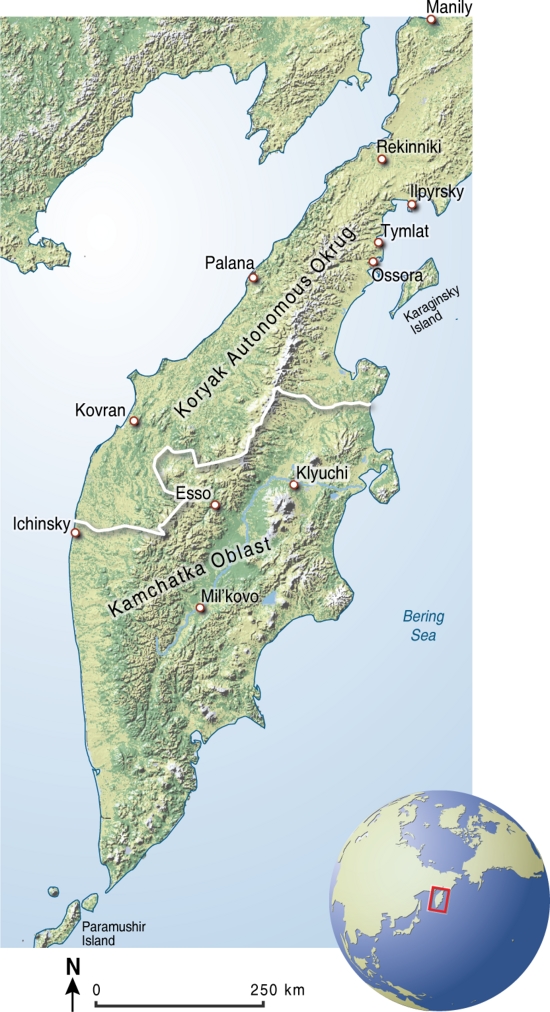
¿Sabrías ubicar la península de Khamchatka en el mapa? ¿Y sus principales ciudades? Apréndelo con este mapa en color, listo para imprimir.
Es un contenido publicado en www.grida.no
Geographical Information“Map, illustrating the communites, cities and sites from where the stories for the 'Indigenous Knowledge in Disaster Management' project has been collected and are refered to in the stories. Please see the project web-site for more information.”
This is a content published at www.grida.no
Asia
Idioma English
Exclusive content for members of

Mira un ejemplo de lo que te pierdes
Autores:
Categories:
Tags:
Shared with:
Si ya eres usuario, Inicia sesión
Add to Didactalia Arrastra el botón a la barra de marcadores del navegador y comparte tus contenidos preferidos. Más info...


Comment
0