What can I do?

226313 materialEducativo

textoFiltroFicha
  • I like 0
  • Visits 6
  • Comments 0
  • Save to
  • Actions

About this resource...

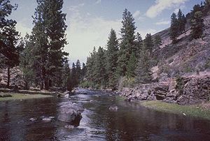
Malheur River
River
Wikipedia articleDbpedia source
The Malheur River (local pronunciation: "MAL-hyure") is a 190-mile-long (306 km) tributary of the Snake River in eastern Oregon in the United States. It drains a high desert area, between the Harney Basin and the Blue Mountains and the Snake.Despite the similarity of name, the river does not flow into nearby Malheur Lake, which is located in the enclosed Harney Basin southwest of the watershed of the river.
Malheur River
Length (km) 305775.360000
Maximum discharge (m³/s) 588.990409
Minimum discharge (m³/s) 0.000000
Mouth elevation (µ) 650.138400
Watershed (km2) 12172944118.579201

Conceptual map: Malheur River

Exclusive content for members of

D/i/d/a/c/t/a/l/i/a
Sign in

Mira un ejemplo de lo que te pierdes

Categories:

Fecha publicación: 30.5.2015

Comment

0

Do you want to comment? Sign up or Sign in

Join Didactalia

Browse among 226313 resources and 561662 people

Regístrate >

O conéctate a través de:

Si ya eres usuario, Inicia sesión

Do you want to access more educational content?

Sign in Join a class
x

Add to Didactalia Arrastra el botón a la barra de marcadores del navegador y comparte tus contenidos preferidos. Más info...

Game help
Juegos de anatomía
Selecciona nivel educativo