What can I do?

226305 materialEducativo

textoFiltroFicha
  • I like 0
  • Visits 7
  • Comments 0
  • Save to
  • Actions

About this resource...

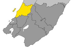
Kapiti Coast District
Wikipedia articleDbpedia source
The Kapiti Coast District is a local government district in the lower North Island of New Zealand 50 km north of Wellington.The district is named after Kapiti Island a prominent landmark 5 km offshore. The population of the district is concentrated in the chain of coastal settlements along State Highway One: Otaki, Te Horo, Waikanae, Paraparaumu, Raumati and Paekakariki. Paraparaumu is the most populous settlement and the commercial and administrative centre. Much of the rural land is given over to horticulture and market gardens are common along the highway between the settlements. Paraparumu has a small airport with daily scheduled flights to Auckland and across Cook Strait to Nelson and Blenheim.The area available for agriculture and settlement is narrow and coastal. Much of the eastern part of the district is part of the Tararua Forest Park which covers the rugged Tararua Range, with peaks rising to over 1500 m.
Kapiti Coast District

Conceptual map: Kapiti Coast District

Exclusive content for members of

D/i/d/a/c/t/a/l/i/a
Sign in

Mira un ejemplo de lo que te pierdes

Categories:

Fecha publicación: 6.9.2014

Comment

0

Do you want to comment? Sign up or Sign in

Join Didactalia

Browse among 226305 resources and 560645 people

Regístrate >

O conéctate a través de:

Si ya eres usuario, Inicia sesión

Do you want to access more educational content?

Sign in Join a class
x

Add to Didactalia Arrastra el botón a la barra de marcadores del navegador y comparte tus contenidos preferidos. Más info...

Game help
Juegos de anatomía
Selecciona nivel educativo