What can I do?

226305 materialEducativo

textoFiltroFicha
  • I like 0
  • Visits 5
  • Comments 0
  • Save to
  • Actions

About this resource...

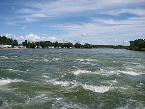
Fairford River
Place
Wikipedia articleDbpedia source
The Fairford River is a river of Manitoba, Canada. It flows out of the North end of Lake Manitoba into Lake Pineimuta and Lake St. Martin. Regulation of Lake Manitoba dates back to the late 1890s and in 1961 the dam on the river, the Fairford River Water Control Structure (FRWCS) was completed to control outflows. The 1961 works also included widening and deepening of the channel, particularly between Lake Manitoba and the dam, more than tripling the capacity when the lake is at a level of 813 feet above sea level. In times of low water, outflows from Lake Manitoba into the Fairford River are reduced, while during high water levels the gates of the control structure are open to allow water to run down the river and into Lake Pinemuta and Lake St. Martin before eventually ending up in Lake Winnipeg via the Dauphin River. Using the Fairford Dam, the water levels are to be regulated between 810.5 and 812.5 feet above sea level. The average annual outflow from Lake Manitoba into the Fairford River between 1972-2001 was 2,029,198 acre feet (2.502979 km3). During the Flood on Lake Manitoba in 2011, at the peak, the Fairford River took on record flows of about 22,000 cfs.
Fairford River

Conceptual map: Fairford River

Exclusive content for members of

D/i/d/a/c/t/a/l/i/a
Sign in

Mira un ejemplo de lo que te pierdes

Categories:

Fecha publicación: 30.5.2015

Comment

0

Do you want to comment? Sign up or Sign in

Join Didactalia

Browse among 226305 resources and 560591 people

Regístrate >

O conéctate a través de:

Si ya eres usuario, Inicia sesión

Do you want to access more educational content?

Sign in Join a class
x

Add to Didactalia Arrastra el botón a la barra de marcadores del navegador y comparte tus contenidos preferidos. Más info...

Game help
Juegos de anatomía
Selecciona nivel educativo