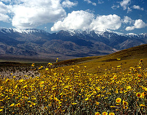
Inyo County is a county in the eastern central part of California, located between the Sierra Nevada mountains and the state of Nevada. As of the 2010 census, the population was 18,546. The county seat is Independence. Inyo County is on the east side of the Sierra Nevada and southeast of Yosemite National Park in Central California. It contains the Owens River Valley; it is flanked to the west by the Sierra Nevada and to the east by the White Mountains and the Inyo Mountains. With an area of 10,192 square miles (26,397 km2), Inyo County is the second-largest county by area in California, after San Bernardino County. Almost one-half of that area is within Death Valley National Park. However, with a population density of 1.8 people per square mile, it also has the second-lowest population density in California, after Alpine County.
Area code
442/760
Area land (m2)
2.63687e+10
Area total (m2)
2.64878e+10
Area water (m2)
1.19139e+08
Founding date
1866-03-22
Maximum elevation (µ)
4421.12
Minimum elevation (µ)
-85.0392
Population as of
2010-04-01
Population total
18546
Subdivision
http://didactalia.net/items/AdministrativeRegion_f7b3f31a-819c-4bdb-8f93-5ced5360fb0b_fb46551e-5637-4481-95af-ef4a2f9377b4
Time zone
http://didactalia.net/items/Dbpedia_36be5967-0108-40ed-99e3-f9ef4c7dd0d2_c6498d42-75ed-423a-8f5d-8ab599b53539
Type
http://didactalia.net/items/Dbpedia_ae882e36-1e8a-4599-8ba3-94d5f8947924_7f822f02-6615-482d-b60c-750b0ae17b77
Utc offset
−7
−8


Comment
0