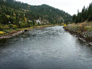
The Clearwater River is a 74.8-mile-long (120.4 km) river in north central Idaho, which flows westward from the Bitterroot Mountains along the Idaho-Montana border, and joins the Snake River at Lewiston. In October 1805, the Lewis and Clark Expedition descended the Clearwater River in dugout canoes, putting in at "Canoe Camp," five miles (8 km) downstream from Orofino. By average discharge, the Clearwater River is the largest tributary of the Snake River. The River got its name for the Niimiipuutímt naming as Koos-Koos-Kai-Kai - “clear water”. The drainage basin of the Clearwater River is 9,645 square miles (24,980 km2). Its mean annual discharge is 15,300 cubic feet per second (430 m3/s)
Length (km)
120378.931200
Maximum discharge (m³/s)
3086.536279
Mouth elevation (µ)
225.856800
Source confluence elevation (µ)
1306.068000
Source elevation (µ)
371.856000
442.874400
Watershed (km2)
24980435324.190720


Comment
0