What can I do?

226313 materialEducativo

textoFiltroFicha
  • I like 0
  • Visits 180
  • Comments 0
  • Save to
  • Actions

About this resource...

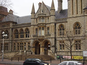
Barrio de Ealing (Londres)
Settlement
Wikipedia articleDbpedia source
Ealing is a suburban district of west London, England and the administrative centre of the London Borough of Ealing. It is located 7.9 miles (12.7 km) west of Charing Cross and around 12 miles (19.3 km) from the City of London. It is one of the major metropolitan centres identified in the London Plan. It was historically a rural village in the county of Middlesex and formed an ancient parish. Improvement in communications with London, culminating with the opening of the railway station in 1838, shifted the local economy to market garden supply and eventually to suburban development. As part of the growth of London in the 20th century, Ealing significantly expanded and increased in population, becoming a municipal borough in 1901 and has formed part of Greater London since 1965. It now forms a significant commercial and retail centre with a developed night time economy. Most of Ealing falls under the W5 and W13 postcodes, with the exception of Hanger Hill, which partly falls under the NW10 postcode area.
Barrio de Ealing (Londres)
Distance to charing cross (µ) 12713.817600

Conceptual map: Barrio de Ealing (Londres)

Exclusive content for members of

D/i/d/a/c/t/a/l/i/a
Sign in

Mira un ejemplo de lo que te pierdes

Categories:

Fecha publicación: 7.9.2014

Comment

0

Do you want to comment? Sign up or Sign in

Join Didactalia

Browse among 226313 resources and 561702 people

Regístrate >

O conéctate a través de:

Si ya eres usuario, Inicia sesión

Do you want to access more educational content?

Sign in Join a class
x

Add to Didactalia Arrastra el botón a la barra de marcadores del navegador y comparte tus contenidos preferidos. Más info...

Game help
Juegos de anatomía
Selecciona nivel educativo