What can I do?

226297 materialEducativo

textoFiltroFicha
  • I like 0
  • Visits 3
  • Comments 0
  • Save to
  • Actions

About this resource...

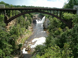
Ausable River (New York)
River
Wikipedia articleDbpedia source
The Ausable River /ɔːˈseɪbəl/, also known as AuSable River and originally written as "Au Sable", runs in the U.S. state of New York, from the Adirondack Mountains and past the village of Lake Placid and Au Sable Forks to empty into Lake Champlain (at 44°33′40″N 73°25′25″W) It has an East and West branch that join at Ausable Forks NY. A few miles east of Keeseville, New York. The river forms a partial boundary between Clinton County and Essex County. The Ausable River is known for its spectacular gorge, Ausable Chasm, and its trout fishing known as one of the best eastern trout rivers in USA.[citation needed]The Ausable River is 94 miles (150 km) long and drains a watershed of 516 square miles (1,340 km2).
Ausable River (New York)

Conceptual map: Ausable River (New York)

Exclusive content for members of

D/i/d/a/c/t/a/l/i/a
Sign in

Mira un ejemplo de lo que te pierdes

Categories:

Fecha publicación: 30.5.2015

Comment

0

Do you want to comment? Sign up or Sign in

Join Didactalia

Browse among 226297 resources and 560155 people

Regístrate >

O conéctate a través de:

Si ya eres usuario, Inicia sesión

Do you want to access more educational content?

Sign in Join a class
x

Add to Didactalia Arrastra el botón a la barra de marcadores del navegador y comparte tus contenidos preferidos. Más info...

Game help
Juegos de anatomía
Selecciona nivel educativo