
Cargando...
What can I do?
Find
Display

Video Economía
All the clues for understanding symbols, scale and relief of the National Topographic Map are in this video. Year of creation: 2019.
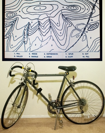
The point of this project is to determine exactly how much of an effect road grade has upon a cyclist’s speed and to determine if the effect follows a predictable mathematical trend.It is an education ...
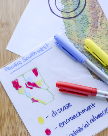
This project aims to tell the story of Earth’s disappearing wildlife, using transparency maps.It is an educational content by education.com.By clicking on the title of this resource, you will be redir ...
How to use topographic and geologic maps.
It is an educational content of CK-12 Foundation (to access some of the CK-12 contents you must be logged in).
Describing landforms as height above sea level.
It is an educational content of CK-12 Foundation (to access some of the CK-12 contents you must be logged in).
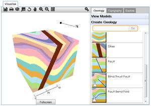
Hipervinculo Geología
Una estupenda herramienta educativa para geología. Con ella puedes generar y visualizar en 3D modelos de bloques geológicos y hacerlos girar hasta 360º. Puedes crear tu propia top ...
Add to Didactalia Arrastra el botón a la barra de marcadores del navegador y comparte tus contenidos preferidos. Más info...


