
Cargando...
What can I do?
Find
Display
FicheroServidor CC SS, Geografía e Historia
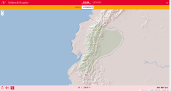
El mapa físico del Ecuador nos ayuda a conocer las provincias y cantones que existen en el país también para conocer los límites y divisiones de cada lugar.

Discover the true shape of the Earth and how cartographic projections allow portray it in a flat surface in different ways depending on the purpose of the map. Year of creation: 2019.

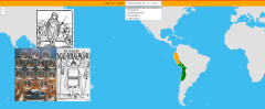
Learn with this interactive game the parts of the Inca Empire.
Zoom in or out of the map and adjust its size to the screen of your device. You can also click on the map and drag it to center it.

Aprender las banderas ya no es un asunto complicado con esta serie de vídeos. Aquí repasaremos las banderas de Dominica, Ecuador, El Salvador, Estados Unidos, Granada, Guatemala, Guyana, ...
Video Historia
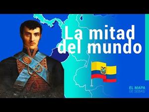
La República del Ecuador es considerada como uno de los países con más diversidad del mundo: por su territorio pasan los Andes y el Amazonas, además de una gran variedad de ...
Would you know how to place the relief of Ecuador on the map? Check it out with this fun interactive Didactalia activity to learn geography.
Enlarge or reduce the map with the zoom and adjust its size ...
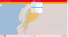
Learn with this interactive game the relief of Ecuador. Choose from the proposed list each element that the map points to.
Enlarge or reduce the map with the zoom and adjust its size to the screen of y ...
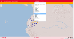
Choose from the proposed list the name of each of the Rivers of Ecuador (Difficult Level) indicated on the map.
Enlarge or reduce the map with the zoom and adjust its size to the screen of your device. ...

Choose from the proposed list the name of each of the rivers of Ecuador (Middle Level) indicated on the map.
Enlarge or reduce the map with the zoom and adjust its size to the screen of your device. Yo ...
Add to Didactalia Arrastra el botón a la barra de marcadores del navegador y comparte tus contenidos preferidos. Más info...


