
Cargando...
Què puc hacer?
Troba
visualització

A tour around the current technologies using satellites and airborne platforms for geographic information in order to study the territory and its changes. Year of creation: 2019.
Hipervinculo Geología
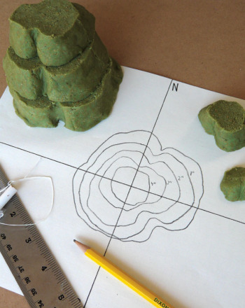
In this project, you will make your own mini-mountain, and then make a contour map of your mountain.It is an educational content by education.com.By clicking on the title of this resource, you will be ...
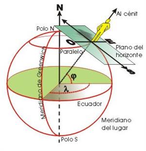
Pon a prueba tus conocimientos acerca de las coordenadas geográficas. Tienes que colocar sobre el planisferio cada una de las coordenadas que te proporcionan. Es un contenido educativo de Educa ...
Afegir a Didactalia Arrastra el botón a la barra de marcadores del navegador y comparte tus contenidos preferidos. Más info...


