
Cargando...
Cosa posso fare?
Trova
 Matematica (10)
Scienze Naturali (67)
Scienze Sociali, Geografia e Storia (326)
Tecnologia (7)
Arti Plastiche, Immagine e Disegno (3)
Arti Sceniche, Musica e Danza (3)
Lingue Straniere (34)
Matematica (10)
Scienze Naturali (67)
Scienze Sociali, Geografia e Storia (326)
Tecnologia (7)
Arti Plastiche, Immagine e Disegno (3)
Arti Sceniche, Musica e Danza (3)
Lingue Straniere (34)
visualizzazione

Although talking about earthquakes and tsunamis sounds exotic, they are very common and happen frequently near us. This video shows why they occur, the trigger and where the possibility of an event is ...

Video Economía
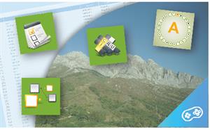
All the clues for understanding symbols, scale and relief of the National Topographic Map are in this video. Year of creation: 2019.

Discover the true shape of the Earth and how cartographic projections allow portray it in a flat surface in different ways depending on the purpose of the map. Year of creation: 2019.

A tour around the current technologies using satellites and airborne platforms for geographic information in order to study the territory and its changes. Year of creation: 2019.
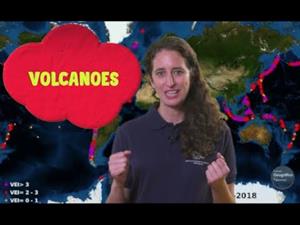
An overview of the types of eruptions, emitted materials and volcanic areas of Spain and the world through stunning videos and images. Year of creation: 2019.
Hipervinculo Geografía
Pon en práctica tus conocimientos geográficos con estos juegos sobre conceptos relacionados con el clima, la vegetación, el relieve, la economía, la población y much ...
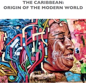
Libro digital, en acceso abierto, resultado del proyecto ConnecCaribbean financiado por la Union Europea y que se desarrolla en el Consejo Superior de Investigaciones Científicas (CSIC).
Contien ...
Según la Wikipedia "la Era del Descubrimiento es un período histórico de exploración global europea que comenzó a principios del siglo XV con los primeros descu ...

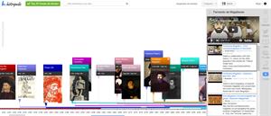
"Historiana is an on-line educational multimedia tool that offers students multi-perspective, cross-border and comparative historical sources to supplement their national history textbooks. Histo ...
Hipervinculo Geografía
Mediante mapas temáticos y gráficos, se describe la realidad de la población española, su distribución y organización, así como la caracterizació ...
Aggiungere a Didactalia Arrastra el botón a la barra de marcadores del navegador y comparte tus contenidos preferidos. Más info...


