
Cargando...
Cosa posso fare?
Trova
 Matematica (19)
 Scienze Naturali (495)
Scienze Sociali, Geografia e Storia (495)
Tecnologia (70)
Arti Plastiche, Immagine e Disegno (15)
Arti Sceniche, Musica e Danza (16)
Filosofia (76)
Lingue Straniere (9)
Cultura e Lingue Classiche (3)
Scienze Naturali (495)
Scienze Sociali, Geografia e Storia (495)
Tecnologia (70)
Arti Plastiche, Immagine e Disegno (15)
Arti Sceniche, Musica e Danza (16)
Filosofia (76)
Lingue Straniere (9)
Cultura e Lingue Classiche (3)
visualizzazione
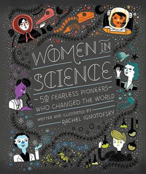
Las 50 mujeres representadas en Women in Science: 50 Fearless Pioneers Who Changed the World que pertenecen a todas las épocas históricas. A través de ilustraciones e infograf&i ...
La mano de Irulegui es una pieza arqueológica hallada en un yacimiento del poblado de la Edad del Hierro, siglo I a. C., situado al pie de las ruinas del castillo de Irulegui en Laquidái ...
Hipervinculo Geografía
Aplicación móvil de mapas interactivos para estudiar la geografía física, política y el paisaje de España y el mundo. Es bilingüe en español e ing ...
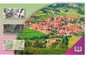
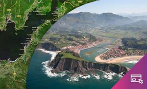
Conjunto de actividades sobre paisaje, toponimia, riesgo ambiental, geomorfología, etc. para trabajar con visualizadores cartográficos. Incluye una guía de uso del visualizador Ib ...
Hipervinculo Geografía
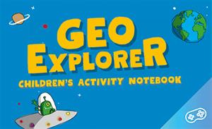
GeoExplorer has come to discover the Earth through games to learn astronomy, the interior of the Earth, geography and maps. Draw, colour, cut and learn more with links to other resources. Aimed at stu ...
Hipervinculo Geografía
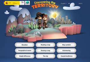
This interactive teaching and learning resource includes nine pills or independent educational materials aimed at learning geography and cartography in a playful way, on topics such as altitude, orien ...
Hipervinculo Geografía
This interactive teaching and learning resource enable us to discover the coastal landforms of Spain, its landscapes and coastal accidents. Coastal features are described: bays, capes, lagoons, beache ...

Hipervinculo Geografía
This teaching and learning resource is used to study settlements that are characterized by a predominant economic activity (mining, agriculture, tourism, industry). By searching for information (maps, ...

This video shows how to orient yourself in the field in a traditional way through the use of a map and a compass, and through the use of map applications for mobile devices. Year of creation: 2019.

In this video GNSS technology foundations and use are explained, and also how it is used in mobile and in other more accurate applications, such as cartography or Earth dynamics knowledge. Year of cr ...
Aggiungere a Didactalia Arrastra el botón a la barra de marcadores del navegador y comparte tus contenidos preferidos. Más info...


