
Cargando...
Cosa posso fare?
Trova
visualizzazione
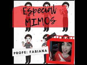
TEATRO 🎭 ESPECIAL MIMOS ¿Qué es un mimo? ¿Cómo es el vestuario? ¿ y el maquillaje? Mimos famosos : Charles Chaplin / Marcel Marceau
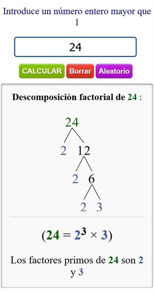
La calculadora de descomposición factorial de números es una excelente herramienta para aprender cómo se puede representar cualquier número entero en un producto de sus fac ...
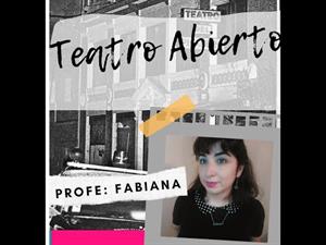
TEATRO 🎭 DICTADURA _ TEATRO ABIERTO El golpe de Estado del 24 de marzo de 1976 derrocó al gobierno de María Estela Martínez de Perón. En su lugar, se instauró una d ...
Hipervinculo Geografía
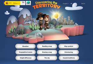
This interactive teaching and learning resource includes nine pills or independent educational materials aimed at learning geography and cartography in a playful way, on topics such as altitude, orien ...

This video shows how to orient yourself in the field in a traditional way through the use of a map and a compass, and through the use of map applications for mobile devices. Year of creation: 2019.

In this video GNSS technology foundations and use are explained, and also how it is used in mobile and in other more accurate applications, such as cartography or Earth dynamics knowledge. Year of cr ...

Although talking about earthquakes and tsunamis sounds exotic, they are very common and happen frequently near us. This video shows why they occur, the trigger and where the possibility of an event is ...

Video Economía
All the clues for understanding symbols, scale and relief of the National Topographic Map are in this video. Year of creation: 2019.

Discover the true shape of the Earth and how cartographic projections allow portray it in a flat surface in different ways depending on the purpose of the map. Year of creation: 2019.

A tour around the current technologies using satellites and airborne platforms for geographic information in order to study the territory and its changes. Year of creation: 2019.
Aggiungere a Didactalia Arrastra el botón a la barra de marcadores del navegador y comparte tus contenidos preferidos. Más info...


