
Cargando...
Que podo facer?
Atopa
visualización

This video shows how to orient yourself in the field in a traditional way through the use of a map and a compass, and through the use of map applications for mobile devices. Year of creation: 2019.

In this video GNSS technology foundations and use are explained, and also how it is used in mobile and in other more accurate applications, such as cartography or Earth dynamics knowledge. Year of cr ...

Hipervinculo Ciencias de la Tierra y Medioambiente
Presents the relationships of facts, explanations, and opinions in science.
It is an educational content of CK-12 Foundation (to access some of the CK-12 contents you must be logged in).
Hipervinculo Ciencias de la Tierra y Medioambiente
Presents the relationships of facts, explanations, and opinions in science.
It is an educational content of CK-12 Foundation (to access some of the CK-12 contents you must be logged in).
Concept of recording the measurements
Concept of data tables in UM
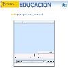
Pon a prueba tus conocimientos acerca de las coordenadas geográficas. Tienes que colocar sobre el planisferio cada una de las coordenadas que te proporcionan. Es un contenido educativo de Educa ...
Engadir a Didactalia Arrastra el botón a la barra de marcadores del navegador y comparte tus contenidos preferidos. Más info...


