
Cargando...
Que podo facer?
Atopa
 Matemáticas (7)
Ciencias Naturais (68)
Matemáticas (7)
Ciencias Naturais (68)
 CC SS, Xeografía e Historia (124)
Tecnoloxía (13)
Artes Plásticas, Imaxe e Deseño (6)
Artes Escénicas, Música e Danza (2)
Filosofía (15)
Linguas Estranxeiras (7)
CC SS, Xeografía e Historia (124)
Tecnoloxía (13)
Artes Plásticas, Imaxe e Deseño (6)
Artes Escénicas, Música e Danza (2)
Filosofía (15)
Linguas Estranxeiras (7)
visualización

Video Economía
All the clues for understanding symbols, scale and relief of the National Topographic Map are in this video. Year of creation: 2019.

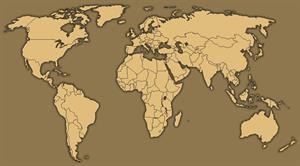
Discover the true shape of the Earth and how cartographic projections allow portray it in a flat surface in different ways depending on the purpose of the map. Year of creation: 2019.

A tour around the current technologies using satellites and airborne platforms for geographic information in order to study the territory and its changes. Year of creation: 2019.

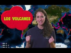
An overview of the types of eruptions, emitted materials and volcanic areas of Spain and the world through stunning videos and images. Year of creation: 2019.
Video Geografía
Un repaso a los tipos de erupciones, los materiales emitidos y las zonas volcánicas de España y el mundo a través de impactantes vídeos e imágenes.
Hipervinculo Historia de España
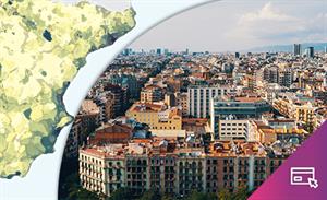
Descubre España a través de mapas, gráficos, tablas e imágenes
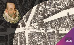
Visualizador interactivo que, sobre el plano de Pedro Texeira (1656), permite recorrer el Madrid del siglo XVI ...
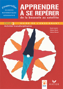
RésuméLe besoin de se repérer sur Terre remonte à l'antiquité et reste très prégnant dans le monde d'aujourd'hui. L'histoire et les techniques qui s'y rattachent sont pour l'enfant une source inépuisa ...
Hipervinculo Geografía
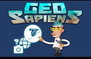
GeoSapiens pone a prueba tus conocimientos sobre geografía física, política y paisaje. Repasa los nombres de los principales accidentes del relieve terrestre y costero, los pa&iac ...
Hipervinculo Geografía
Mediante mapas temáticos y gráficos, se describe la realidad de la población española, su distribución y organización, así como la caracterizació ...
Ahora que está tan de moda el storytelling, contar una (buena) historia que despierte emociones, José González nos recuerda que es un método ya usado por su profesor de Ge ...
Engadir a Didactalia Arrastra el botón a la barra de marcadores del navegador y comparte tus contenidos preferidos. Más info...


