
Cargando...
Que puis-je faire ?
Trouvez
 Matematiques (18)
 Sciences Naturelles (348)
Sc. Soc., Géographie Et Histoire (348)
Technologie (31)
Arts Plastiques, Image Et Design (16)
Arts De La Scène, Musique Et Danse (12)
Philosophie (33)
Langues Étrangères (11)
Sciences Naturelles (348)
Sc. Soc., Géographie Et Histoire (348)
Technologie (31)
Arts Plastiques, Image Et Design (16)
Arts De La Scène, Musique Et Danse (12)
Philosophie (33)
Langues Étrangères (11)
visualisation
Hipervinculo CC SS, Geografía e Historia
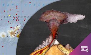
¿Qué sabes sobre los volcanes?
Presentación sobre volcanes que resume algunos conceptos generales sobre esta materia e incluye enlaces a documentación de consulta, actividad ...
Hipervinculo CC SS, Geografía e Historia
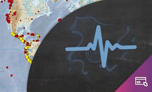
¿Qué sabes sobre los terremotos y los tsunamis?
Presentación sobre terremotos y tsunamis que resume algunos conceptos generales sobre esta materia e incluye enlaces a documentaci&o ...
Hipervinculo Recurso transversal
Proyecto anual gamificado par adar a conocer los ODS, implicarse en ellos e integrarlos en el currículum escolar.
Mediante una narrativa donde los habitantes de Koi, un exoplaneta similar a la T ...
Hipervinculo Geografía
Aplicación móvil de mapas interactivos para estudiar la geografía física, política y el paisaje de España y el mundo. Es bilingüe en español e ing ...
Hipervinculo Geografía
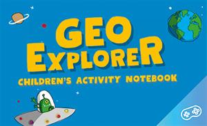
GeoExplorer has come to discover the Earth through games to learn astronomy, the interior of the Earth, geography and maps. Draw, colour, cut and learn more with links to other resources. Aimed at stu ...
Hipervinculo Geografía
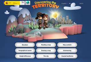
This interactive teaching and learning resource includes nine pills or independent educational materials aimed at learning geography and cartography in a playful way, on topics such as altitude, orien ...
Hipervinculo Geografía
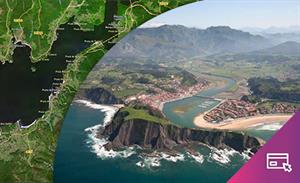
This interactive teaching and learning resource enable us to discover the coastal landforms of Spain, its landscapes and coastal accidents. Coastal features are described: bays, capes, lagoons, beache ...
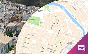
By means of this interactive teaching and learning resource students will learn about an aspect of urban geography: the importance of environmental conditioning factors or the possible risks involved ...

Hipervinculo Geografía
This teaching and learning resource is used to study settlements that are characterized by a predominant economic activity (mining, agriculture, tourism, industry). By searching for information (maps, ...

This video shows how to orient yourself in the field in a traditional way through the use of a map and a compass, and through the use of map applications for mobile devices. Year of creation: 2019.
Ajouter à Didactalia Arrastra el botón a la barra de marcadores del navegador y comparte tus contenidos preferidos. Más info...


