
Cargando...
Que puis-je faire ?
Trouvez
visualisation

This video shows how to orient yourself in the field in a traditional way through the use of a map and a compass, and through the use of map applications for mobile devices. Year of creation: 2019.

In this video GNSS technology foundations and use are explained, and also how it is used in mobile and in other more accurate applications, such as cartography or Earth dynamics knowledge. Year of cr ...
Hipervinculo Ciencias Sociales
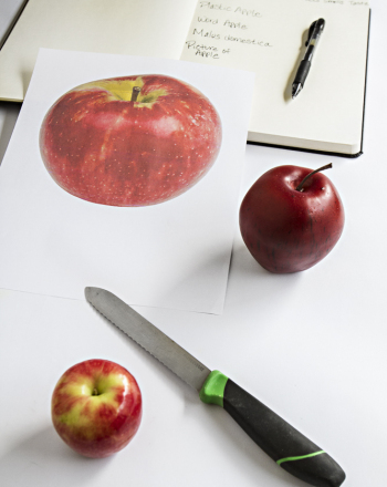
The purpose of this exercise is to have students understand and appreciate the importance of firsthand observation in scientific study.It is an educational content by education.com.By clicking on the ...
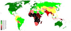
La población humana es el número de personas que habitan un país o región. En siete países se concentra más de la mitad de la población mundial.
Aqu&iac ...
Ajouter à Didactalia Arrastra el botón a la barra de marcadores del navegador y comparte tus contenidos preferidos. Más info...


