
Cargando...
Zer egin dezaket?
Aurkitu
 Matematika (10)
Natur Zientziak (67)
Gizarte Zientziak, Geografia Eta Historia (326)
Teknologia (7)
Arte Plastikoak, Irudia Eta Diseinua (3)
Arte Eszenikoak, Musika Eta Dantza (3)
Atzerriko Hizkuntzak (34)
Matematika (10)
Natur Zientziak (67)
Gizarte Zientziak, Geografia Eta Historia (326)
Teknologia (7)
Arte Plastikoak, Irudia Eta Diseinua (3)
Arte Eszenikoak, Musika Eta Dantza (3)
Atzerriko Hizkuntzak (34)
ikustea
"To learn about the characteristics of the continental climate and its location on the Continent." Fuente: Proyecto Agrega Distribution of the influence of the continental climate in Americ ...
Hipervinculo Geografía
"To learn about the origin and distribution of the mountain ranges of the American continent. " Fuente: Proyecto Agrega Distribution of the Continent's mountain ranges es un material ed ...
Hipervinculo Geografía
"To learn about the characteristics of the Mediterranean climate and its location on the Continent. " Fuente: Proyecto Agrega Areas of influence of the Mediterranean climate es un recurso e ...
Hipervinculo Geografía
"Interactive play methodology: example of Mediterranean island ecosystem. Particular emphasis on the richness of its sea beds, highlighting their importance for avian fauna. Endemic species." ...
Hipervinculo Geografía
"To learn about the climatic characteristics of the American continent and the different climates existing within it." Fuente: Proyecto Agrega America, climatic distribution of the continen ...
Hipervinculo Geografía
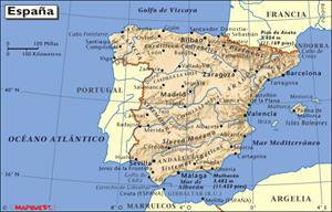
"Knowing the nature of the administrative division in the Community and on what areas it is based. " Fuente: Proyecto Agrega
Administrative division in La Rioja es un recurso educativo public ...
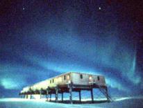
The Ozone Hole, es una página en inglés que trata en cuatro temas sobre el problema de la capa de Ozono.
The discovery of the Ozone Hole
Recent Ozone loss over Ant ...
Hipervinculo Geografía
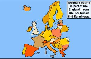
Un ejercicio interactivo de Geografía para estudiantes de Primer ciclo de Educación Secundaria. El objetivo del juego es que el alumno sitúe en el mapa cada uno de los país ...
Hipervinculo Economía
Recurso didáctico para las clases de ciencias sociales. Aquí encontrarás mapas de todo el mundo, organizados por continentes, regiones, países y océanos. Dentro de ...
Hipervinculo Economía
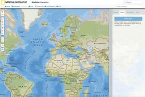
Herramienta educativa creada por National Geographic que permite seleccionar una región o país del mundo y generar mapas con los datos que interesen: clima, población, zonas horar ...
Didactalia-ri Gehitzea Arrastra el botón a la barra de marcadores del navegador y comparte tus contenidos preferidos. Más info...


