
Cargando...
What can I do?
Find
Display
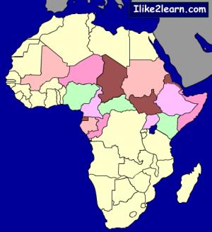
Locate each of the countries of Africa on the map. Drag and drop the pieces of this map in the right place.
On mobile you can enlarge or reduce the map with the zoom and adjust the size to the screen o ...
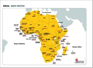
Aprenderse los países y capitales de África no es una tarea sencilla, por esto te recomendamos estudiarlas con este mapa político de dicha zona geográfica.
Si quieres demostrar lo que sabes de geografía política de África, con este mapa político mudo de la zona puedes hacerlo intentando completarlo correctamente.
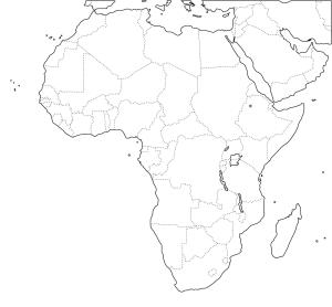
¿Sabes dónde se sitúa cada país de África? Demuéstralo completando este mapa político mudo de África listo para imprimir.
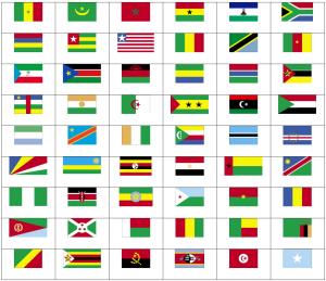
Can you name the flags of Africa?
Test your knowledge of Africa by taking this Africa map quiz.
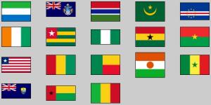
Try to find out the flag of each given western Africa country.
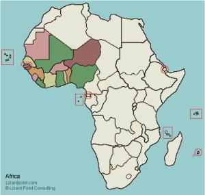
Try to find out on the map each given country of western Africa.
Potrebbe trovare caratteristiche geografiche che vengono richiesti sulla mappa? È necessario indicare ogni posizione precisa sulla mappa.
Individuare le caratteristiche geografiche sono le seguenti: Al ...
Completo mapa interactivo para repasar los países más grandes del mundo.
Los países a localizar son los siguientes: República Centroafricana, Afganistán, Alemania, Angola, rabia Saudita, Argelia, Arge ...
Add to Didactalia Arrastra el botón a la barra de marcadores del navegador y comparte tus contenidos preferidos. Más info...


