
Cargando...
What can I do?
Find

This video shows how to orient yourself in the field in a traditional way through the use of a map and a compass, and through the use of map applications for mobile devices. Year of creation: 2019.

In this video GNSS technology foundations and use are explained, and also how it is used in mobile and in other more accurate applications, such as cartography or Earth dynamics knowledge. Year of cr ...
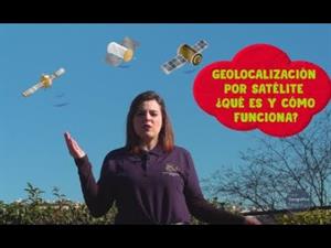
En este video se explican de forma sencilla los fundamentos del GNSS y cómo se emplea para estas aplicaciones y otras que requieren mayores precisiones, como la cartografía o el conocimi ...
Hipervinculo Economía
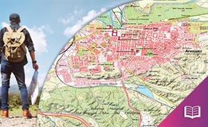
Libro digital que presenta los conceptos básicos de la Cartografía. Lo hace a través de seis secciones: Conceptos básicos en cartografía; Organización institu ...
Migrating animals use Earth's magnetic field for navigation.
It is an educational content of CK-12 Foundation (to access some of the CK-12 contents you must be logged in).
Hipervinculo Ciencias de la Tierra y Medioambiente
Use GPS to find geocaches for a fun outdoor recreation.
It is an educational content of CK-12 Foundation (to access some of the CK-12 contents you must be logged in).
IKTak Lehen Hezkuntzan didaktikoki aplikatzeko sekuentzia didaktikoa.
Didactic sequence for the didactic application of the TIC in Primary Education.
Secuencia didáctica para la aplicación didáctica de las TIC en Educación Primaria.

IKTak Lehen Hezkuntzan didaktikoki aplikatzeko sekuentzia didaktikoa.
Add to Didactalia Arrastra el botón a la barra de marcadores del navegador y comparte tus contenidos preferidos. Más info...


