
Cargando...
What can I do?
Find
Display
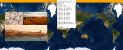
Learn with this interactive game the largest deserts in the world.
Zoom in or out of the map and adjust its size to the screen of your device. You can also click on the map and drag it to center it.
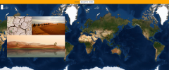
Learn with this interactive game the largest deserts in the world.
Zoom in or out of the map and adjust its size to the screen of your device. You can also click on the map and drag it to center it.
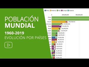
En este vídeo podrás observar la evolución demográfica de los 20 países con más población del mundo desde 1960 hasta nuestros días según ...
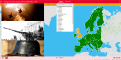
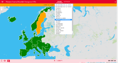
Learn with this interactive game the countries that formed the Europe of 1938 in moments before the Second World War. Choose from the proposed list each country that is pointing to the map.
Enlarge or ...
Impara con questo gioco interattivo i paesi che formarono l'Europa del 1914 in alcuni momenti prima della prima guerra mondiale. Scegli dall'elenco proposto ogni paese che punta alla mappa.
Ing ...
A pesar de que el País Vasco ha visto partir un gran número de marinos y exploradores, pocos han dejado una huella tan indeleble como aquella que marcó la figura del pasaitarra Jo ...
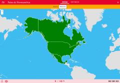
Could you locate on the map the countries of North America? You have to point out each exact location on the map.
Zoom in or zoom out the map in order to adjust it to the size of your desktop’s d ...
¿Sabes situar correctamente los países de América del Norte? Demuéstralo con este mapa político mudo de la zona.
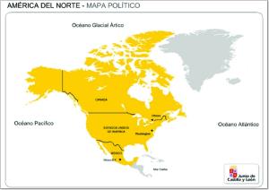
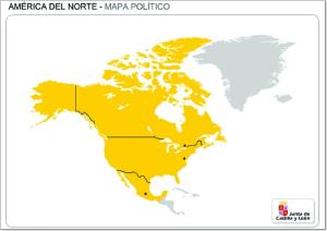
Mapa en el que se pueden ver los países que forman parte de América del Norte.
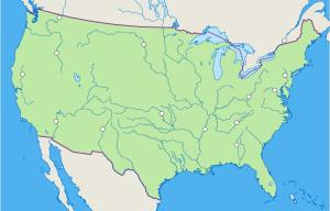
Mapa interactivo de Estados Unidos en el que se trata de identificar los principales ríos que recorren el país
Add to Didactalia Arrastra el botón a la barra de marcadores del navegador y comparte tus contenidos preferidos. Más info...


