
Cargando...
What can I do?
Find
 Mathematics (100)
Natural Sciences (578)
Mathematics (100)
Natural Sciences (578)
 Social Sciences, Geography And History (4135)
Technology (276)
Visual Arts (238)
Performing Arts, Music And Dance (195)
Philosophy (631)
Foreign Languages (38)
Culture And Classical Languages (56)
Social Sciences, Geography And History (4135)
Technology (276)
Visual Arts (238)
Performing Arts, Music And Dance (195)
Philosophy (631)
Foreign Languages (38)
Culture And Classical Languages (56)
Display
Hipervinculo Geografía
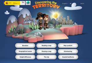
This interactive teaching and learning resource includes nine pills or independent educational materials aimed at learning geography and cartography in a playful way, on topics such as altitude, orien ...
Hipervinculo Geografía
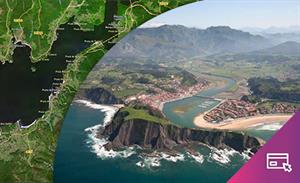
This interactive teaching and learning resource enable us to discover the coastal landforms of Spain, its landscapes and coastal accidents. Coastal features are described: bays, capes, lagoons, beache ...
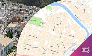
By means of this interactive teaching and learning resource students will learn about an aspect of urban geography: the importance of environmental conditioning factors or the possible risks involved ...

Hipervinculo Geografía
This teaching and learning resource is used to study settlements that are characterized by a predominant economic activity (mining, agriculture, tourism, industry). By searching for information (maps, ...

Hipervinculo Geografía
This interactive teaching and learning resource offers the possibility of knowing through maps the territorial inequalities where factors of an economic, political, social and geographic nature conve ...
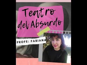
Teatro absurdo
El siglo XX puede caracterizarse como una época de esplendor en el campo científico, la educación de las masas, la evolución tecnológica y artís ...
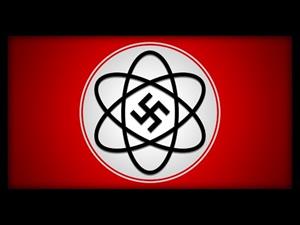
Las ideas nazis no solo se filtraron en la política y en el arte... También lo hicieron en la física. Es hora de que hablemos sobre la absurda "Física Aria" y qué ocurrió con sus creadores.
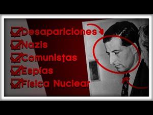
Nazis, espías, contrabando, comunistas, descubrimientos increíbles, fortunas perdidas, romance, desapariciones, suspense... La vida de Bruno Pontecorvo es increíble. Hoy vas a descubrirla.

This video shows how to orient yourself in the field in a traditional way through the use of a map and a compass, and through the use of map applications for mobile devices. Year of creation: 2019.

In this video GNSS technology foundations and use are explained, and also how it is used in mobile and in other more accurate applications, such as cartography or Earth dynamics knowledge. Year of cr ...
Add to Didactalia Arrastra el botón a la barra de marcadores del navegador y comparte tus contenidos preferidos. Más info...


