
Cargando...
¿Qué puedo hacer?
Encuentra
 Matemáticas (4)
 Ciencias Naturales (42)
CC SS, Geografía e Historia (15)
Artes Escénicas, Música y Danza (3)
Ciencias Naturales (42)
CC SS, Geografía e Historia (15)
Artes Escénicas, Música y Danza (3)
visualización
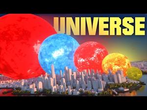
¿Cómo sería el universo si la Tierra apenas midiera 1 cm?
Este vídeo de MetaBallStudios muestra los tamaños relativos de estrellas, nebulosas y galaxias a una escala ...
![SI los PAÍSES fueran PLANETAS ▬ (SUPERFICIE) 🗺 [3D]. MetaBallStudios](https://content.gnoss.ws/imagenesEnlaces/d3/d39f/d39f480a-6431-48ae-9188-0b6b227777b5/d39f480a-6431-48ae-9188-0b6b227777b5.jpg?5)
A video that shows the surface area of SOME countries (including the sea). Not all countries are there for obvious reason...
Una interesante comparativa animada de la superficie de diversos país ...
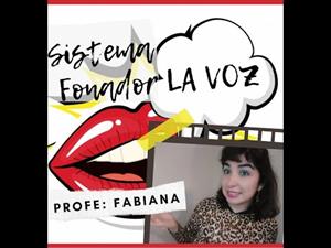
TEATRO 🎭 : APARATO FONADOR - EJERCICIOS VOCALES 🔴INVITADA ESPECIAL: PROFESORA GEORGINA PERAZZO Ningún instrumento puede igualar en belleza a la VOZ HUMANA. Es muy importante que cuidemos nues ...
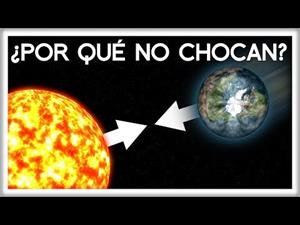
Ya sabes que la Tierra gira alrededor del Sol y que el Sol atrae gravitacionalmente a la Tierra. Pero si el Sol tira de la Tierra, ¿cómo es que no ha caido en espiral hacia él? So ...

This video shows how to orient yourself in the field in a traditional way through the use of a map and a compass, and through the use of map applications for mobile devices. Year of creation: 2019.

In this video GNSS technology foundations and use are explained, and also how it is used in mobile and in other more accurate applications, such as cartography or Earth dynamics knowledge. Year of cr ...

Although talking about earthquakes and tsunamis sounds exotic, they are very common and happen frequently near us. This video shows why they occur, the trigger and where the possibility of an event is ...

Video Economía
All the clues for understanding symbols, scale and relief of the National Topographic Map are in this video. Year of creation: 2019.

Discover the true shape of the Earth and how cartographic projections allow portray it in a flat surface in different ways depending on the purpose of the map. Year of creation: 2019.

A tour around the current technologies using satellites and airborne platforms for geographic information in order to study the territory and its changes. Year of creation: 2019.
Añadir a Didactalia Arrastra el botón a la barra de marcadores del navegador y comparte tus contenidos preferidos. Más info...


