
Cargando...
Què puc hacer?
Troba
 Matemàtiques (17)
Ciències Naturals (510)
CS, Geografia I Història (1314)
Tecnologia (50)
Arts Plàstiques, Imatge I Disseny (35)
Arts Escèniques, Música I Dansa (37)
Filosofia (234)
Llengües Estrangeres (18)
Matemàtiques (17)
Ciències Naturals (510)
CS, Geografia I Història (1314)
Tecnologia (50)
Arts Plàstiques, Imatge I Disseny (35)
Arts Escèniques, Música I Dansa (37)
Filosofia (234)
Llengües Estrangeres (18)
visualització

Una paleta de actividades para infantil y primaria rediseñada según la taxonomía de Bloom, en el contexto de formación en Red del ITEF. la taxonomía de Benjam&iacut ...

Esta edición ilustrada de la DUDH fue creada y diseñada en una colaboración entre el artista Yacine Ait Kaci (YAK) creador de Elyx, el Centro Regional de Información de las ...
Provincias de la región interandina
Hipervinculo Geografía
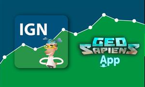
Aplicación móvil de mapas interactivos para estudiar la geografía física, política y el paisaje de España y el mundo. Es bilingüe en español e ing ...
Hipervinculo Geografía
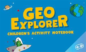
GeoExplorer has come to discover the Earth through games to learn astronomy, the interior of the Earth, geography and maps. Draw, colour, cut and learn more with links to other resources. Aimed at stu ...
Hipervinculo Geografía
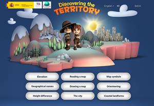
This interactive teaching and learning resource includes nine pills or independent educational materials aimed at learning geography and cartography in a playful way, on topics such as altitude, orien ...

This video shows how to orient yourself in the field in a traditional way through the use of a map and a compass, and through the use of map applications for mobile devices. Year of creation: 2019.

In this video GNSS technology foundations and use are explained, and also how it is used in mobile and in other more accurate applications, such as cartography or Earth dynamics knowledge. Year of cr ...

Although talking about earthquakes and tsunamis sounds exotic, they are very common and happen frequently near us. This video shows why they occur, the trigger and where the possibility of an event is ...

Video Economía
All the clues for understanding symbols, scale and relief of the National Topographic Map are in this video. Year of creation: 2019.
Afegir a Didactalia Arrastra el botón a la barra de marcadores del navegador y comparte tus contenidos preferidos. Más info...


